Google Deploy Planes For Map Battle
Bangalore: Google is not giving any chance to rivals when it comes to its most popular App, Google Maps. After the rumors about Apple replacing Google Maps with its own service, the search giant is introducing many enhancements to make the Maps irresistible.
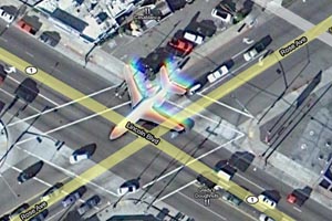 As a part of this, Google is literally mapping each and every corner of the world by every way possible- deploying planes to take 3-D photographs to a Street View Trekker, who carries a portable technology backpack with a 360 degree camera to take pictures of the regions only accessible by foot!
Google is also launching the option for Android users to view the maps offline and is planning to make the facility available for other platforms soon. According to Brian McClendon, head of Google maps, “the company has almost driven more than 5 million unique miles as part of its five-year quest to build more accurate maps from its own raw data rather than licensing map content from others.”
A 3-D image of all metropolitan cities will be available to users in Google Earth, later this year and for this purpose, Google had already deployed a fleet of camera equipped small planes above several cities. "We're trying to create the illusion that you're just flying over the city, almost as if you were in your own personal helicopter," said Peter Birch, a product manager for Google Earth. Earlier, the company’s street view project has invited lot of criticism and lawsuits. But with the new steps, Google made it clear that they are not rolling back the creation of a digital map of the world.
“We expect innovation to speed up. While we never will be able to build the perfect map, we’re going to get much, much closer than we are today,” McClendon said.