Gadgets which have become Obsolete
By siliconindia

Maps
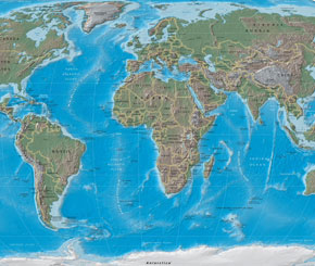 There was a time when travelers used to carry paper maps-which were bigger than everything-everywhere. Paper maps have been created and used since the development if basic geographic principles-the foundation of geographic analysis established by Claudius Ptolemy during the second century CE. By the 16th century, the Mercartor map was introduced by the cosmographer and topographer Gerhard Mercator. The first globe was presented in 1541, and later a procedure for gathering information using statistics and land revenue figures were put on paper, pioneered in Akbar's Empire in India. With the introduction of aerial photography, the remote sensing, modern day maps and digital marketing came to the forefront. The mapping software development began with Howard Fisher, who automated the mapping system and from there evolved the associated databases-which still is a standard for the GIS industry. The data about the Earth was constantly updated, and grew to provide a basis for the GPS (Global Positioning System), which helped to track the movement anywhere in the planet. As a popularity of digital navigation systems grew, the traditional cartography was ousted from the market. The California State Automobile Association produced its last paper map in 2008.